 Photo: Wikimedia contributors · See source
Bernese Oberland Lakes
Link Thun, Oberhofen, Interlaken, Lauterbrunnen and Brienz on a four-day loop around two great lakes.
- Allow
- 4 days
- Route
- 175 km
- Drive time
- 2 hr 37 min
- Stops
- 7
Lake Thun and Lake Brienz give this circuit a clean geographic rhythm. Thun begins with castle roofs and an active river, Oberhofen brings gardens to the shore, and Interlaken becomes the practical base for a car-free excursion into the Lauterbrunnen valley.
The car does not improve every hour. Park at Lauterbrunnen or Wilderswil and use local trains and buses where access rules or congestion demand it. On the return, the north shore of Lake Brienz trades spectacle for quieter villages and changing water light.
The road, in one glance
Pinch or scroll with Ctrl / ⌘ to zoom
Drawing the route…
The route earns
its distance
Each pin is selected as a place to do something—not merely proof that you passed through.
 Photo: Wikimedia contributors · See source
Bern
Start after the capital stay and leave the city outside commuter peaks.
Bern (Swiss Standard German: ), or Berne (French: ), is the de facto capital of Switzerland, referred to as the "federal city". With a population of about 146,000 (as of 2024), Bern is the fifth-most populous city in Switzerland, behind Zurich, Geneva, Basel and Lausanne. The Bern agglomeration, which includes 36 municipalities, had a population of 406,900 in 2014.
 Photo: Wikimedia contributors · See source
Thun
A castle, covered river locks and lake views make a complete first day.
Thun is a town and a municipality in the administrative district of Thun in the canton of Bern in Switzerland. It is located where the Aare flows out of Lake Thun (Thunersee), 30 kilometres (19 miles) southeast of Bern. As of December 2018 the municipality has about 45,000 inhabitants and around 80,000 live in the agglomeration.
 Photo: Wikimedia contributors · See source
Oberhofen Castle
Turrets and gardens meet the water on Lake Thun’s quieter north shore.
Oberhofen Castle is a castle in the municipality of Oberhofen of the Canton of Bern in Switzerland. It is a Swiss heritage site of national significance.
 Photo: Wikimedia contributors · See source
Interlaken
Between two lakes, this transport hub is the sensible two-night base for the valley.
Interlaken is a Swiss resort town on the flat land between Lake Thun and Lake Brienz, with the Aare connecting the two waters. Railways and mountain transport make it the principal gateway for excursions into the Bernese Oberland, including the Lauterbrunnen and Grindelwald valleys.
Photo: Wikimedia contributors · See sourceLauterbrunnen
Waterfalls fall from sheer walls into one of Switzerland’s defining glacial valleys.
Lauterbrunnen is a village and municipality in the Interlaken-Oberhasli administrative district in the canton of Bern in Switzerland. The municipality comprises the other villages of Wengen, Mürren, Gimmelwald, Stechelberg, and Isenfluh, as well as several other hamlets. The population of the village of Lauterbrunnen is less than that of Wengen, but larger than that of the others.
 Photo: Wikimedia contributors · See source
Brienz
Woodcarving traditions and a turquoise shoreline slow the route before the return west.
Brienz is a village and municipality on the northern shore of Lake Brienz, at the foot of the Brienzer Rothorn mountain, and in the Bernese Oberland region of Switzerland. Besides the village of Brienz, the municipality includes the settlements of Kienholz and Axalp. Politically, the municipality is located in the Interlaken-Oberhasli administrative district of the canton of Bern.
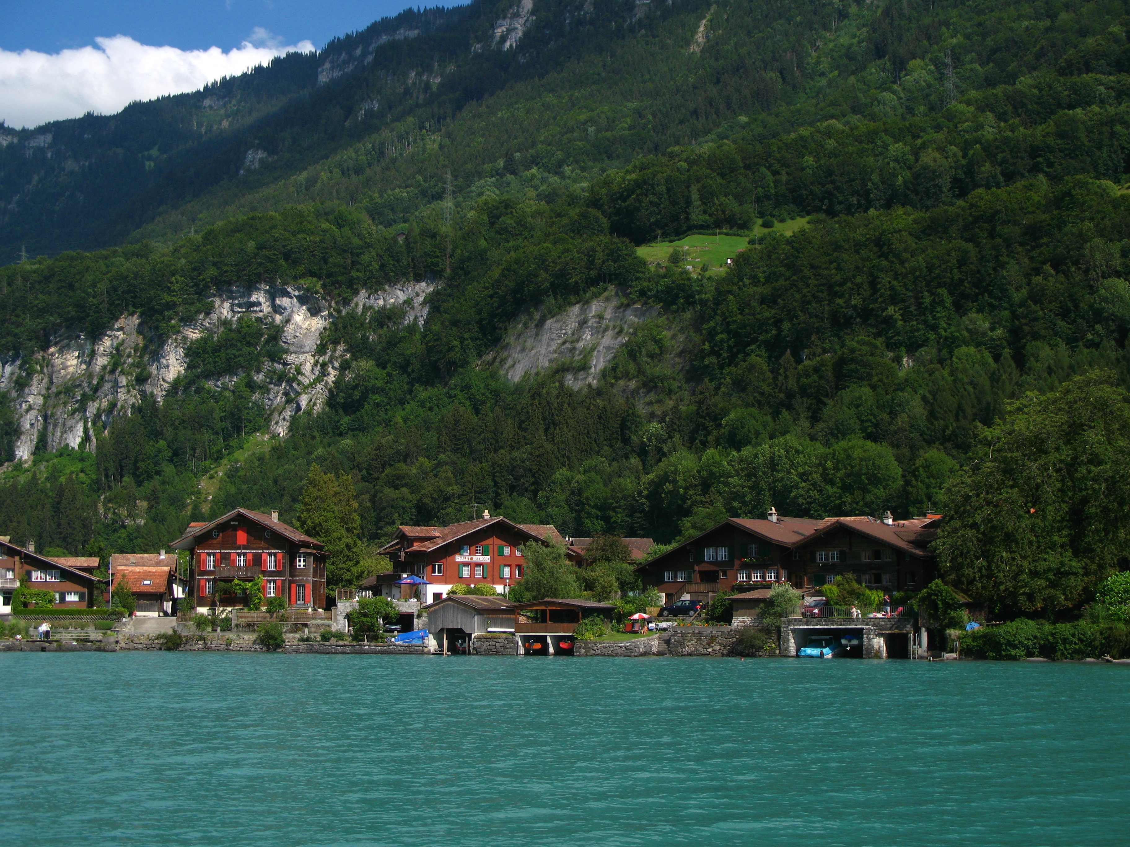 Photo: Wikimedia contributors · See source
Iseltwald
A compact peninsula village gives Lake Brienz a final intimate viewpoint.
Iseltwald is a village and municipality on the southern shore of Lake Brienz in the Bernese Oberland region of Switzerland. Politically, the municipality is located in the Interlaken-Oberhasli administrative district of the canton of Bern.
Drive the conditions,
not the itinerary.
Park before mountain-valley excursions, never enter residents-only lanes and check lake-road works. Do not attempt car-free Wengen or Mürren by road.
Checked against
the people who run it
Distances and driving times are planning estimates. Conditions, closures, ferries, permits and park rules can change, so check the linked official guidance before setting out.